


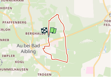

8,5 km | 15,9 km-effort

Tous les sentiers balisés d’Europe GUIDE+


Kostenlosegpshiking-Anwendung
 SityTrail
IGN / Geografische Institute
SityTrail World
Die Welt öffnet sich für Sie
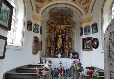
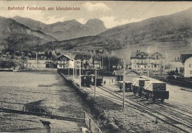
Tour Zu Fuß von 5,3 km verfügbar auf Bayern, Landkreis Rosenheim, Bad Feilnbach. Diese Tour wird von SityTrail - itinéraires balisés pédestres vorgeschlagen.
Trail created by Bad Feilnbach.
Symbol: Blaue Schilder mit weißem Pfeil
 "
data-pinterest-text="Pin it"
data-tweet-text="share on twitter"
data-facebook-share-url="https://www.sitytrail.com/de/trails/3095806-bad-feilnbach--nordic-walking-blau-xbibereckx/?photo=1#lg=1&slide=1"
data-twitter-share-url="https://www.sitytrail.com/de/trails/3095806-bad-feilnbach--nordic-walking-blau-xbibereckx/?photo=1#lg=1&slide=1"
data-googleplus-share-url="https://www.sitytrail.com/de/trails/3095806-bad-feilnbach--nordic-walking-blau-xbibereckx/?photo=1#lg=1&slide=1"
data-pinterest-share-url="https://www.sitytrail.com/de/trails/3095806-bad-feilnbach--nordic-walking-blau-xbibereckx/?photo=1#lg=1&slide=1">
"
data-pinterest-text="Pin it"
data-tweet-text="share on twitter"
data-facebook-share-url="https://www.sitytrail.com/de/trails/3095806-bad-feilnbach--nordic-walking-blau-xbibereckx/?photo=1#lg=1&slide=1"
data-twitter-share-url="https://www.sitytrail.com/de/trails/3095806-bad-feilnbach--nordic-walking-blau-xbibereckx/?photo=1#lg=1&slide=1"
data-googleplus-share-url="https://www.sitytrail.com/de/trails/3095806-bad-feilnbach--nordic-walking-blau-xbibereckx/?photo=1#lg=1&slide=1"
data-pinterest-share-url="https://www.sitytrail.com/de/trails/3095806-bad-feilnbach--nordic-walking-blau-xbibereckx/?photo=1#lg=1&slide=1">
 "
data-pinterest-text="Pin it"
data-tweet-text="share on twitter"
data-facebook-share-url="https://www.sitytrail.com/de/trails/3095806-bad-feilnbach--nordic-walking-blau-xbibereckx/?photo=2#lg=1&slide=2"
data-twitter-share-url="https://www.sitytrail.com/de/trails/3095806-bad-feilnbach--nordic-walking-blau-xbibereckx/?photo=2#lg=1&slide=2"
data-googleplus-share-url="https://www.sitytrail.com/de/trails/3095806-bad-feilnbach--nordic-walking-blau-xbibereckx/?photo=2#lg=1&slide=2"
data-pinterest-share-url="https://www.sitytrail.com/de/trails/3095806-bad-feilnbach--nordic-walking-blau-xbibereckx/?photo=2#lg=1&slide=2">
"
data-pinterest-text="Pin it"
data-tweet-text="share on twitter"
data-facebook-share-url="https://www.sitytrail.com/de/trails/3095806-bad-feilnbach--nordic-walking-blau-xbibereckx/?photo=2#lg=1&slide=2"
data-twitter-share-url="https://www.sitytrail.com/de/trails/3095806-bad-feilnbach--nordic-walking-blau-xbibereckx/?photo=2#lg=1&slide=2"
data-googleplus-share-url="https://www.sitytrail.com/de/trails/3095806-bad-feilnbach--nordic-walking-blau-xbibereckx/?photo=2#lg=1&slide=2"
data-pinterest-share-url="https://www.sitytrail.com/de/trails/3095806-bad-feilnbach--nordic-walking-blau-xbibereckx/?photo=2#lg=1&slide=2">

Zu Fuß
Zu Fuß
Zu Fuß
Zu Fuß
Zu Fuß
Zu Fuß
Zu Fuß
Zu Fuß

Zu Fuß